Cutting-edge digital tools adapted to the challenges of Senegalese agriculture, from the field to data analysis.
From field collection to strategic analysis, Suqali Mbay Mi covers the entire agricultural data cycle.
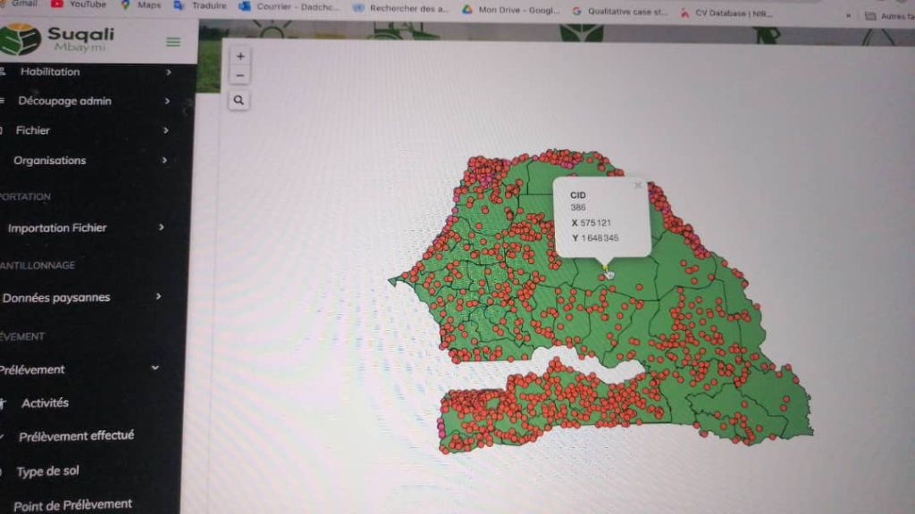
Our GIS platform offers interactive, real-time visualisation of all agricultural data collected across Senegal. Over 5,000 sampling points mapped across all 14 regions.
Every point on the map is enriched with detailed information: unique identifier (CID), precise GPS coordinates, soil type, agronomic data and intervention history.
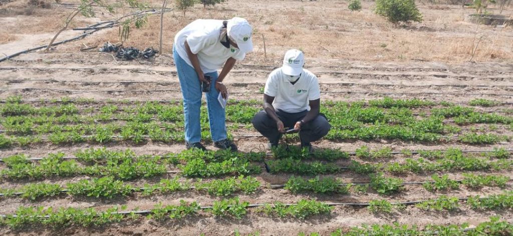
Our mobile app was designed for real African field conditions: low connectivity areas, users unfamiliar with technology, need for fast and accurate data entry.
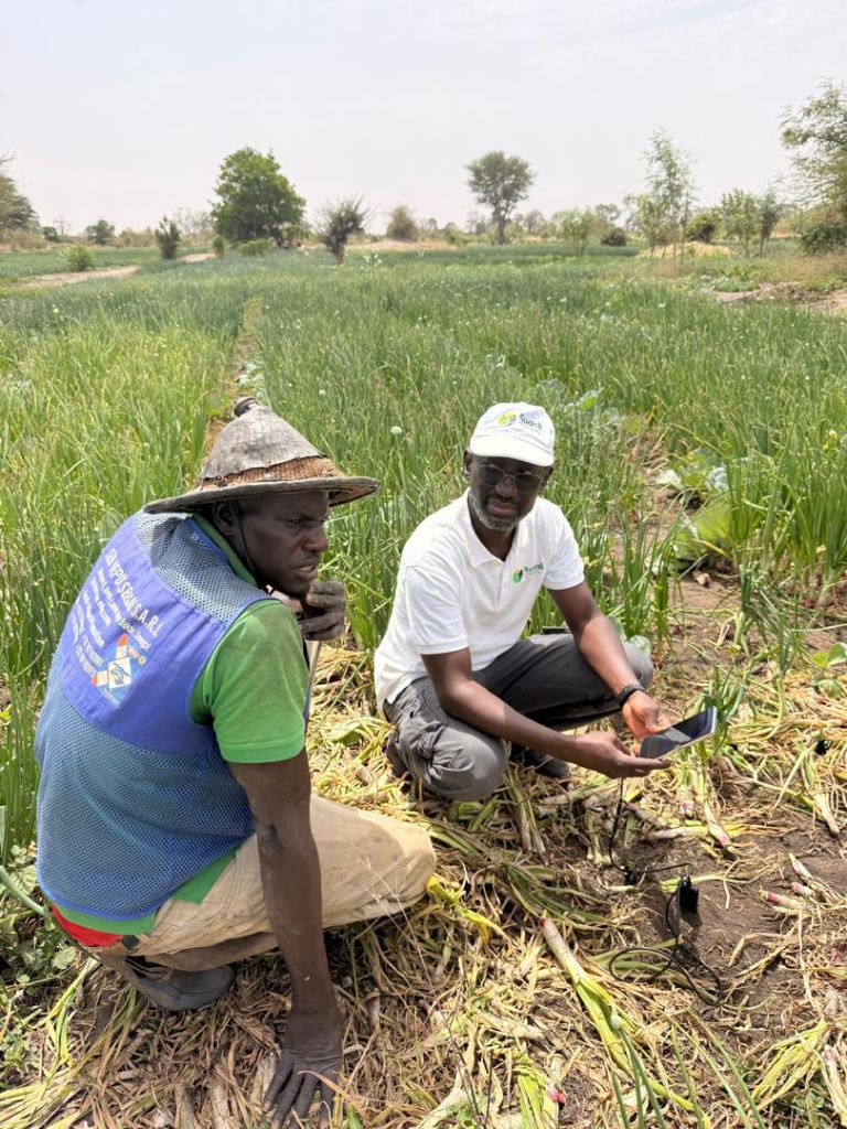
The app allows agents to collect agronomic data, take photos, record GPS coordinates and automatically synchronise everything to the central platform.
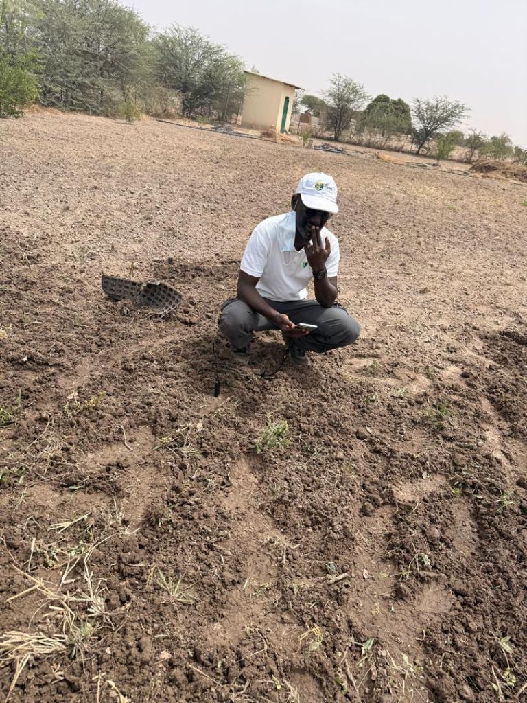
Our team of agronomists and field technicians carries out rigorous monitoring of agricultural plots. Soil analysis, crop health surveillance, personalised recommendations and early warnings of issues.
Each farm receives a complete digital file: crop history, soil analysis results, past interventions and forecasts for upcoming seasons.
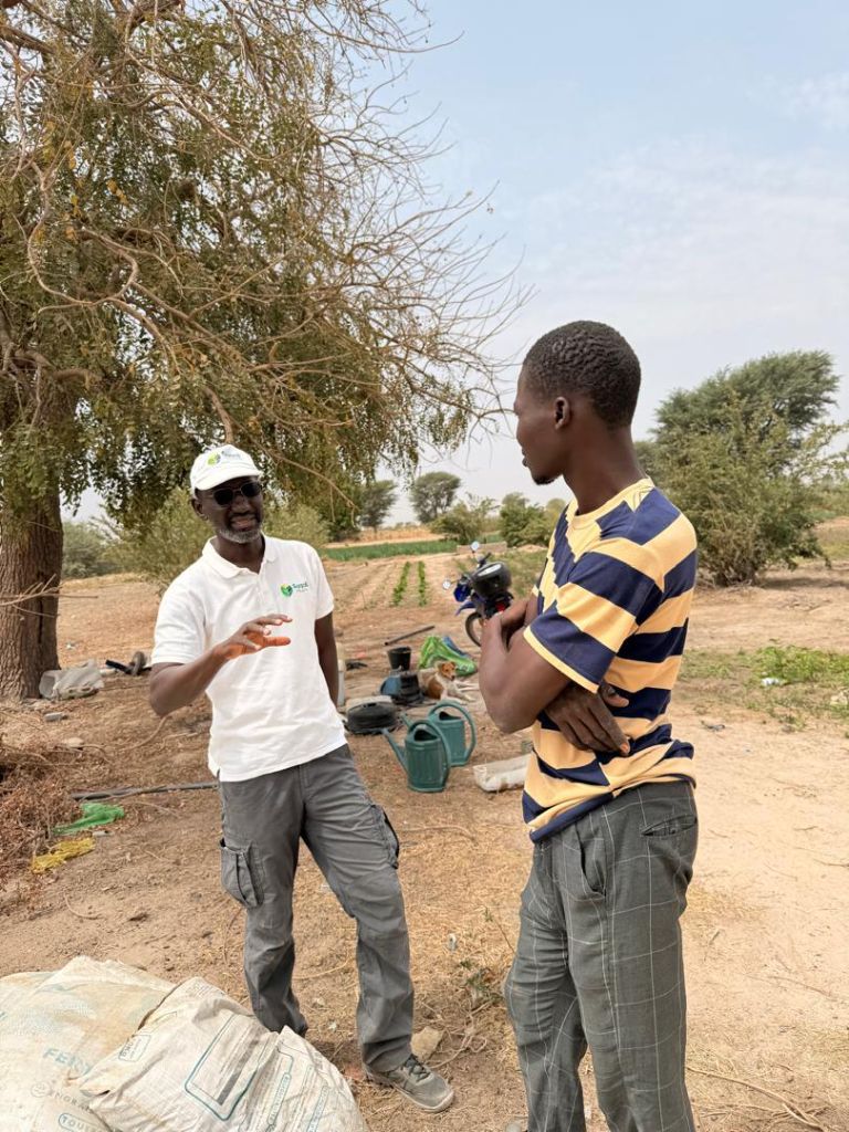
Our field agents travel directly to farmers. The objective: equipping them with the skills to use digital tools and sustainably improve their practices.
Beyond technical training, we assist farmers in analysing their results and making strategic decisions for their operations.
Our centralised dashboard allows organisations, cooperatives and institutions to monitor agricultural performance indicators in real time across their intervention zones.
Fully customisable, it provides advanced charts, pivot tables and automatic exports to facilitate reporting and decision-making.
We support agricultural organisations, NGOs and institutions in their digital transition. Our training covers the use of GIS tools, field data collection and analytics results.
Practical training adapted to each participant's level, delivered in French and local languages (Wolof, Pulaar) to ensure maximum adoption.
Flexible packages for individual farmers, cooperatives and organisations.
For small farmers and individual operations
For GIEs, cooperatives and farmer groups
For NGOs, institutions and large-scale projects
Find answers to the most common questions about our services and solutions.
Access to the mobile app is included in all our packages. Farmers supported by our field teams receive direct access as part of the service. For independent access, please contact us for a tailored quote.
Yes, absolutely. The application was specifically designed for areas with poor connectivity. It features a full offline mode: agents collect all data without connection, which syncs automatically as soon as a network is available.
Depending on the scale of the project, basic deployment takes between 2 and 4 weeks. This includes system configuration, agent training and initial data integration. For large-scale institutional projects, we plan a phased 2 to 3-month deployment.
Yes. Our platform provides a documented REST API that enables integration with third-party management tools, agricultural ministry databases or donor reporting systems. Contact our technical team to discuss your specific integration needs.
Yes. All our training materials are available in French, Wolof and Pulaar to ensure maximum adoption by farmers and field agents. We can also adapt materials to other local languages on request.
Tell us about your project and our team will propose the solution best suited to your needs.