How digitalisation is transforming Senegalese agriculture
The AgriTech revolution is underway in Senegal. From satellite mapping and mobile field applications to data analytics, digital tools are redefining how Senegalese farmers manage their operations.
Agriculture still represents 15% of Senegal's GDP and employs more than 60% of the active population. Yet the sector has long suffered from a lack of reliable data and management tools suited to local realities. That is precisely the gap Suqali Mbay Mi aims to fill.
Data at the service of farmers
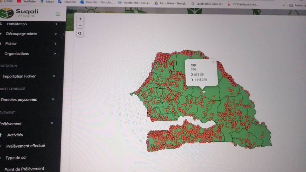
Our geographic information system (GIS) now enables real-time visualisation of over 5,000 sampling points distributed across all 14 regions of Senegal. Each point represents a plot or an agent intervention, with precise information on soil type, crop status and intervention history.
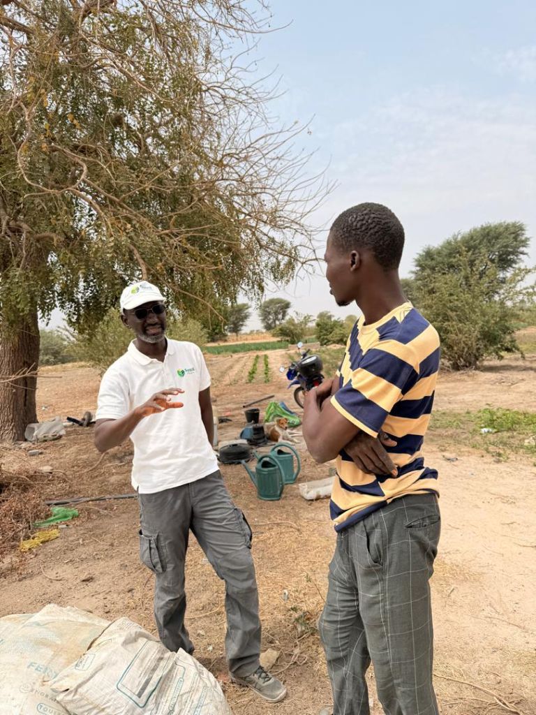
For farmers, access to this data concretely transforms their daily lives. Where they previously relied on intuition or neighbours' advice, they can now make objective data-based decisions: which fertiliser to use, when to irrigate, how to allocate their resources.
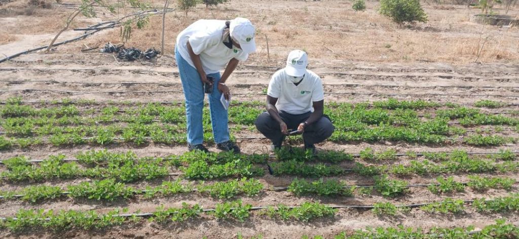
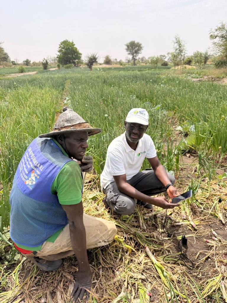
The mobile app: the bridge between field and data
At the heart of our system, the mobile app developed by our team plays a central role. Working even without internet connection — an inescapable reality in many rural Senegalese areas — it enables our agents to collect data directly in the field with centimetre-level GPS precision.
- Automatic geolocation of each plot
- Soil data recording (pH, moisture, texture)
- Photos linked to sampling points
- Automatic sync via Wi-Fi or 3G/4G
Towards a Senegalese Agriculture 4.0
The challenge goes far beyond simple data collection. It is about building a genuine national digital agricultural infrastructure, capable of informing policy decisions, directing investment and enabling farmers to get the best from their work. Suqali Mbay Mi contributes to this every day, one farmer at a time, one plot at a time.